External vs. Integral GPS
The location protocol beacons tested obtain their GPS location via
two dissimilar means that offer various advantages and disadvantages.
The operation of beacons using an external GPS source and those with
an internal, or integral, GPS receiver are markedly different and not
always directly comparable.
Beacons using an external GPS source have generally been less expensive
than those with an internal GPS receiver. Especially for a consumer
who already owns a GPS receiver and for one who uses a GPS for navigation
purposes, this can result in a more economical total purchase cost
with similar distress signaling benefits.
Having an external GPS source requires that the owner/operator connect
the GPS to the beacon. All current beacons require a physical connection.
The ACR external GPS beacons evaluated come with a proprietary infrared
adapter that terminates in two bare wires. This adapter provides a
waterproof connection to the beacon as there is no physical connection
between the interior and exterior of the beacon case, but the wires
must be connected to an adapter to fit the external GPS.
On some units by other manufacturers that were not evaluated, the
adapter is not included and must be purchased. On some units the connection
is a plug and receptacle that may not be waterproof, not via an infrared
connector.
There is no universal standard for the GPS data output connector used
for this purpose; sometimes not even within a GPS manufacturer's product
line. As a result, the owner must acquire a GPS adapter from the manufacturer
or elsewhere and either assemble their own interface cord or have one
manufactured for them using the beacon's adapter. In most cases, the
GPS adapter is not waterproof or submersible, although most appear
to be very water-resistant. The interface cord for our evaluation was
provided by the ACR Electronics representative attending the evaluation
who had personally assembled it.
External GPS receivers have the potential, at least when compared
to the current generation of GPS enhanced beacons, of being more capable
of acquiring a location under difficult conditions. This can be attributed
to a combination of any or all of better receiver, software, and antenna.
EPIRBs using an external GPS source in most marine installations use
the boat's own generally very capable high-performance GPS receiver
that is permanently connected to the EPIRB held in its storage bracket.
In such installations the GPS is generally equipped with a high-performance
external GPS antenna that provides much-improved reception compared
to the internal antennas on a handheld GPS receiver or within an integral
GPS beacon. In such an installation, the EPIRB is constantly being
updated with the latest GPS location and would be expected to have
received a GPS location from the GPS prior to being activated and deployed.
This would not be the case for an EPIRB in an abandon-ship bag or in
a life raft survival equipment pack.
In situations where a user of a beacon, typically a PLB in this case,
is going to be entering an area or circumstances where they know that
it is unlikely that a GPS location can be acquired, an area with heavy
overhead canopy, a narrow canyon, or where they might fall into a crevasse,
for example, they can load a location into the beacon beforehand, possibly
providing a nearby location for SAR to work with and the attendant
advantages when they might otherwise not be able to do so. Note, that
while the beacons tested retain this location in memory forever or
until the beacon is activated and then deactivated again, the COSPAS-SARSAT
standard has been changed since they were originally approved and any
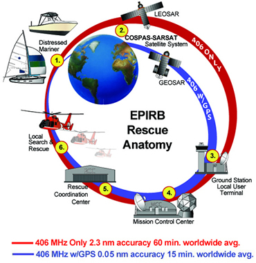
recently approved model beacons discard the location after four hours.
A beacon and an external GPS generally represent a bulkier and weightier
package than a single integrated device. With an external GPS beacon,
the user must contend with two devices and a connecting cord, at least
with existing beacon and GPS interfaces. Deployment and activation
can be more difficult when having to handle multiple devices. The survivor
must know how to switch on and properly orient the GPS for satellite
reception. In a situation where the owner or normal operator of the
beacon is incapacitated or unavailable, and the person operating the
distress signaling gear is not familiar with the gear, these issues
can become a bigger liability.
Beacons using external GPS do not update their position unless manually
switched off and on again while a GPS is still connected. Typically,
the user isn't aware of this as an option as it is usually only explained
in the operator's manual. Experience suggests that many owners do not
read the operator's manual or review it only cursorily. This is not
a disadvantage for inland use where survivors will typically remain
in the same location until rescue, or at least until contact is made
with SAR. It is a potential deficiency in marine use, but as noted
in the following discussion of integrated GPS beacon advantages, this
is of practical use in only a very limited number of SAR scenarios.
The primary advantage of an integral GPS beacon is in the packaging—everything
is self-contained. This is an advantage especially for PLBs where size
and weight typically are major considerations.
Another advantage is that there is no need for a user to be familiar
with the operation of the GPS receiver, or how to connect the two devices
together. Simply activating the beacon also activates the GPS. In general,
operation of the beacon is easy and self-evident to a degree, although
most beacons examined by the authors do not do a very good job of instructing
the user in optimum operation with regards gaining a GPS location.
Beacons with integral GPS are allowed to update their position every
20 minutes, though this isn't a requirement. This is of little advantage
for inland use, but it is a potential advantage in maritime use in
a minority of survival circumstances.
The value of the ability to update location under current search and
rescue protocols used in the U.S. SAR community is limited, even in
the maritime environment where movement due to wind, current, and waves
is the norm. Current protocol is to provide the initial location to
SAR forces who launch on that information. In the vast majority of
circumstances in response to a GPS-enabled 406 MHz alert, SAR resources
will arrive on scene within an hour or two. Unless a new location is
significantly distant from the original, they will not be provided
with it enroute. Typically, they find the survivor(s) within viewing
distance of the original location as drift is generally slow enough
that they will not have moved a significant distance in the interval,
or SAR on scene can quickly determine the direction and speed of drift
and can thereby locate the survivor(s).
If the survivor(s) is a person in the water in a PFD, rather than
an easier-to-detect vessel or life raft, then the probability of detection
is much lower and the value of updated location information becomes
greater. If the SAR resource that first arrives on the scene does not
promptly locate the survivors, they may contact their operations control
and should receive an updated position at that time. Movement due to
drift is more significant an issue in blue water conditions far from
land, where the time to arrive on scene may be measured in hours or
even days. Extreme conditions can also increase the rate of drift to
a sometimes surprising degree. In such instances, updated location
has the potential to be much more valuable.
It is also expected that the on-scene SAR resource will use their
121.5 MHz homing capability to locate the survivors upon arrival, if
necessary. In some instances crews do not even turn on direction-finding
equipment unless they fail to locate survivor(s) initially. The instances
when this tool is useful with 406 MHz location protocol alerts are
relatively few because the overall location accuracy is so good. However,
in those cases where it is needed, there are a number of potential
problems with this strategy, not the least of which being both the
poor overall performance of 121.5 homing in some conditions, and the
poor performance of some aircrews in use of existing direction-finding
equipment to quickly locate 121.5 MHz transmission sources.
It is expected that the increased utilization of self-locating beacons
will engender a change in strategy to provide enroute updates more
readily and resultant potential for improved rescue response times
in such scenarios. In addition, new direction-finding equipment has
been introduced that directly receives and translates the location
data, and provides improved directional guidance using the more robust
406 MHz data burst, which will provide on-scene communication directly
from the beacon to SAR resources. This improved capability is just
beginning to be put into service, but will eventually make its way
into the majority of the SAR fleet. Once available, it will likely
become a primary location tool as SAR resources approach the scene.
Integral GPS beacons are generally more expensive than those relying
upon an external GPS. In many situations the ability of the internal
GPS to acquire a location under poor reception conditions, at least
that we have seen in current generation beacons, may not be as good
as that available from a high quality external GPS. With packaging
limitations, that may be the situation for some time to come, but it
should not be considered inherently so.
Operation of the GPS receiver is a significant drain on the battery,
as users of handheld GPS units have often discovered to their dismay
when they have no spare batteries available. Manufacturers have developed
proprietary operating schemes that minimize the operation of the GPS
receiver, while at the same time theoretically providing adequate time
to acquire a location. This is an effort to limit battery consumption,
and thereby the size of the battery, which is a prime component that
determines the overall size of the beacon, and to a lesser degree,
the cost.
As COSPAS-SARSAT specifications allow the transmitted location to
be updated no less than every 20 minutes, there is no need to operate
the GPS continuously. Between operating periods, the GPS receiver is
put into "sleep" mode to conserve power, waking up to check for location
and, if necessary, update the location, every 20 minutes in the models
tested. The initial operating period of the GPS receiver may be longer
than subsequent periods, although not necessarily so, to allow additional
time to acquire and download the ephemeris data and almanac.
Some industry observers have suggested that the difficulty some integral
GPS beacons may have in acquiring a location could be related to an
initial operating period that is too short. In the Key West Test report's
summary (see Appendix 1), one suggestion is that "beacons be designed
to try to acquire GPS locations for time periods of at least [15] minutes." The
ACR beacon already complies with this suggestion. The Techtest beacon
initially attempts to acquire for a total of four 5-minute periods
alternating with 5-minute sleep periods. McMurdo has an initial period
of 5 minutes duration. There is no way to determine solely by independent
observation if the length of the initial GPS operational period is
a contributor to any integral GPS beacon's location performance deficit
in this evaluation.
A good argument can be made that the ideal self-locating beacon would
offer both the option of using an external GPS when that is advantageous
and would also have an internal GPS for situations when that is an
advantage. Shortly after the completion of these field tests ACR Electronics
announced the upcoming availability of a
PLB that offers this capability.
Message from Scuba Steve:
Be sure to visit http://www.scubasteve.biz to
make your purchase.


